CBA Kazakhstan: Demonstrating Adaptive Land Management in Priozernoye (Association of Landscape Planning Development)
Project Overview


The Priozernoye community is located approximately 150km north of Kazakhstan's capital, Astana. It sits in the transition zone between the dry and moderately-dry steppes, and the community's economy is predominantly focused on production of spring wheat. Winter snowfall is the most important precipitation for agriculture, as meltwater provides the moisture required for agricultural production. In the case of Priozernoye, declining precipitation and an increasing rainfall-to-snowfall ratio threatens to intensify erosion and desertification on the sloping lands; rainfall is more likely to run off, rather than slowly infiltrate. Climate change pressures will likely compound this effect as temperatures rise and evapotranspiration increases.
In response to the shift towards a warmer and dryer climate, this Community-Based Adaptation project builds on baseline sustainable agro-ecosystem management and rehabilitation initiatives to pilot new agricultural practices adapted to a changing climate. The project also includes capacity development components for the community, and a component on lesson sharing with government and other national stakeholders.
* This project is part of Kazakhstan's Community-Based Adaptation portfolio. *


Project Details
Priozernoye sits approximately 150 Km north of Kazakhstan’s capital, Astana, in the transition zone between the dry and moderately-dry steppe. The land is composed of low to moderate sloping hills and the main economy activity is the production of spring wheat. Winter snowfall is the most important precipitation for agriculture, as melt-water provides the moisture required for agricultural production. Declining precipitation and an increasing rainfall-to-snowfall ratio threaten to intensify erosion and desertification on the sloping lands as rainfall is more likely to run off, rather than slowly infiltrate. This is likely to be compounded by rising temperatures and increased evapotranspiration.
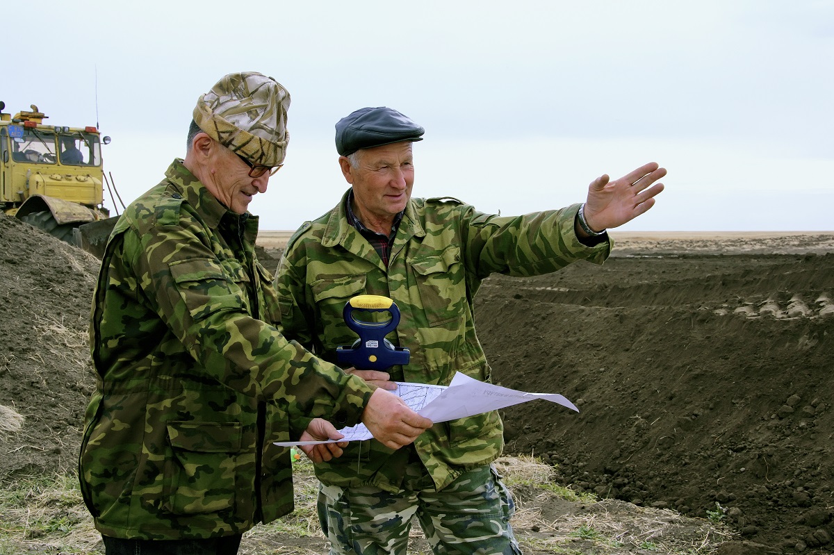
This Community-Based Adaptation project demonstrates new approaches and methods of sustainable land management at the local level. The project was prepared through a participatory process carried out by the Association of Landscape Planning Development and incorporated many different sectors of the local community. It seeks to not only restore existing infrastructural elements, but also to implement water and soil conservation measures that conserve moisture, prevent erosion, and create conditions for commercial grain production while protecting biodiversity.
To achieve this, the project will first establish optimum ratios of land-use to be incorporated into an ecological framework for land management. It will then facilitate sustainable community land resource management using techniques that incorporate climate change-related risk. The emphasis will be on problems of water conservation, reducing the risk of increased soil erosion, and slowing humus loss caused by climate change.
Key Results and Outputs
Outcome 1 (co-financing): Restoration of existing land infrastructure
Reconstruct 2 destroyed dykes and plant trees/fences for reinforcement (Output 1.1). Reconstruct 5 culverts and 2 water-guiding shafts of 2km length (Output 1.2).
Outcome 2 (co-financing): Environmental stabilization of the landscapes
Form pastures on former grain-producing lands (Output 2.1) by flattening ravines and gullies (Output 2.2), soil productivity at the former field camp (Output 2.3), and developing a landscape-environmental plan of the territory (Output 2.4).
Outcome 3 (CBA-funded): Agricultural landscape management integrates changing climate parameters
Develop an agri-landscape zoning map to identify various land categories according to cultivation conditions for grain crops (Output 3.1). Calculate water balance to identify potentially appropriate waterworks locations (Output 3.2) Optimize the agricultural land structure to reduce aridity and improve environmental services (Output 3.3). Implement conservation-oriented crop rotation (Output 3.4) and differentiate farming elements to maximize adaptive intensification (Output 3.5).
Outcome 4 (CBA-funded): Improved community capacity to address climate change risks
Train community in the potential consequences and risks associated with climate change while promoting sustainable and climate-resilient agricultural practices and alternative land tenure practices (Output 4.1).
Outcome 5 (CBA-funded): Project results inform climate change risk management in other communities as well as national and local government
Document lessons learned (Output 5.1) and incorporate them into adaptation techniques for local district development plans (Output 5.2). Monitor, advocate, and disseminate new arable land management strategies among local and national stakeholders (Output 5.3).
Reports and Publications
Annual Reports
PIFs
Project Brief / Fact Sheet
Monitoring and Evaluation
Monitoring and evaluation for community-based adaptation is a new field, and the CBA project is piloting innovative approaches to evaluating the success of locally-driven adaptation projects, and generating lessons to inform ongoing practice.
Key considerations in M&E for CBA include:
- Grounding M&E in the local context: M&E for CBA should avoid overly rigid frameworks, recognizing community heterogeneity and maintaining local relevance
- Capturing global lessons from local projects: CBA projects are highly contextualized, but lessons generated should be relevant to stakeholders globally
- Incorporation of both quantitative and qualitative indicators: to ground projects in tangible changes that can be objectively evaluated, and to capture lessons and case studies for global dissemination
To these ends, the CBA project uses three indicator systems: the Vulnerability Reduction Assessment, the Small Grants Programme Impact Assessment System, and the UNDP Climate Change Adaptation Indicator Framework.
The Vulnerability Reduction Assessment (VRA)
The VRA is a question-based approach with the following aims:
- To make M&E responsive to community priorities
- To use M&E to make projects more accountable to local priorities
- To make M&E capture community ideas and local knowledge
- To gather community-level feedback to guide ongoing project management
- To generate qualitative information
- To capture lessons on specific issues within community-based adaptation
- To generate case studies highlighting adaptation projects
The VRA follows UNDP's Adaptation Policy Framework, and is measured in a series of meetings with local community stakeholders. In these meetings, locally-tailored questions based on standard VRA questions/indicators are posed, and the community assigns a numerical score on a 1-10 scale for each question. Progress is evaluated through changes in scores over the course of implementation, as well as through qualitative data collected in community discussions surrounding the exercise.
UNDP has developed a Users Guide to the VRA (Espanol) (Francais) as a tool to assist practitioners to conceptualize and execute VRA measurements in the context of CBA projects.
The SGP Impact Assessment System (IAS)
The CBA, being a project of the GEF Strategic Priority on Adaptation, aims to increase the resilience of ecosystems and communities to the impacts of climate change, generating global environmental benefits, and increasing their resilience in the face of climate change impacts. To this end, the CBA projects use the SGP's impact assessment system for monitoring achievements in GEF focal areas (focusing primarily on biodiversity and sustainable land management).
The IAS is composed of a number of quantitative indicators which track biophysical ecosystem indicators, as well as policy impact, capacity development and awareness-building.
UNDP Climate Change Adaptation Indicator Framework
CBA projects also track quantitative indicators from UNDP's adaptation indicator framework, corresponding to the thematic area on natural resources management. More information on UNDP's indicator framework can be found on the UNDP climate change adaptation monitoring and evaluation website.
* This description applies to all projects implemented through UNDP's Community-Based Adaptation programme. Specific details on this project's M&E will be included here as they become available. *